![]() indicates difficult places to traverse.
indicates difficult places to traverse.
![]() indicates thick bush.
indicates thick bush.
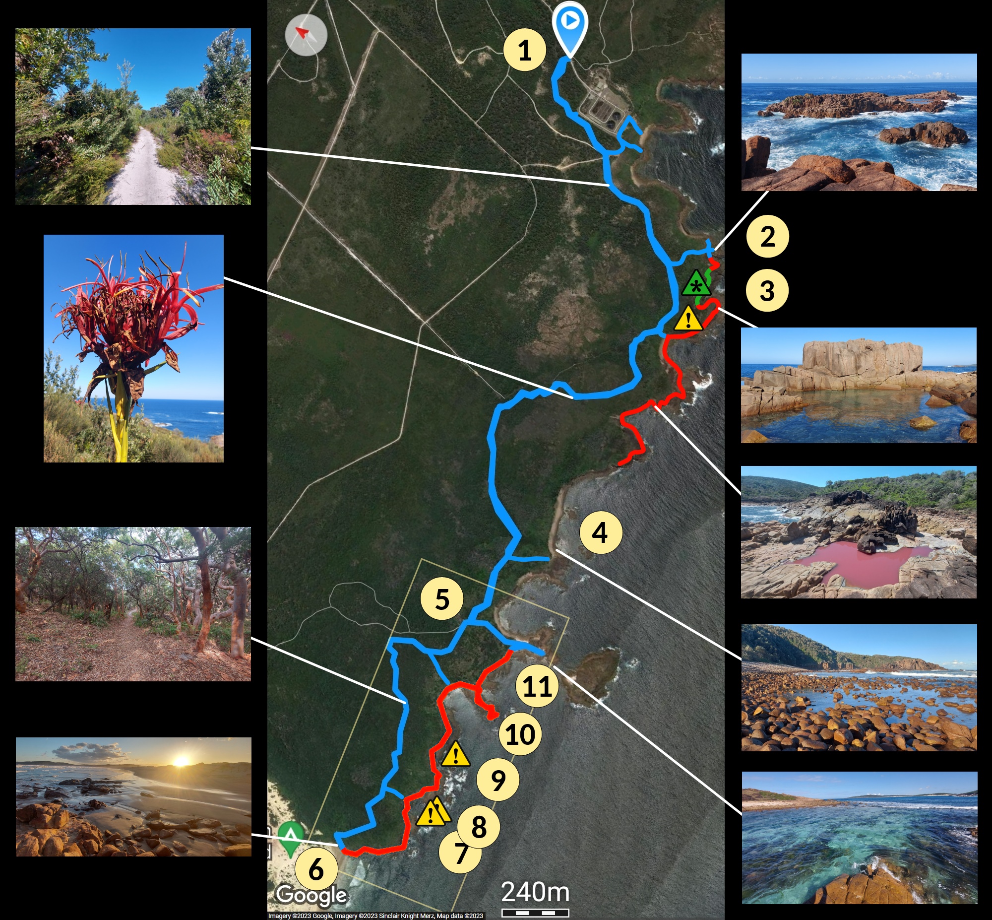
An enlargement of the lower area:
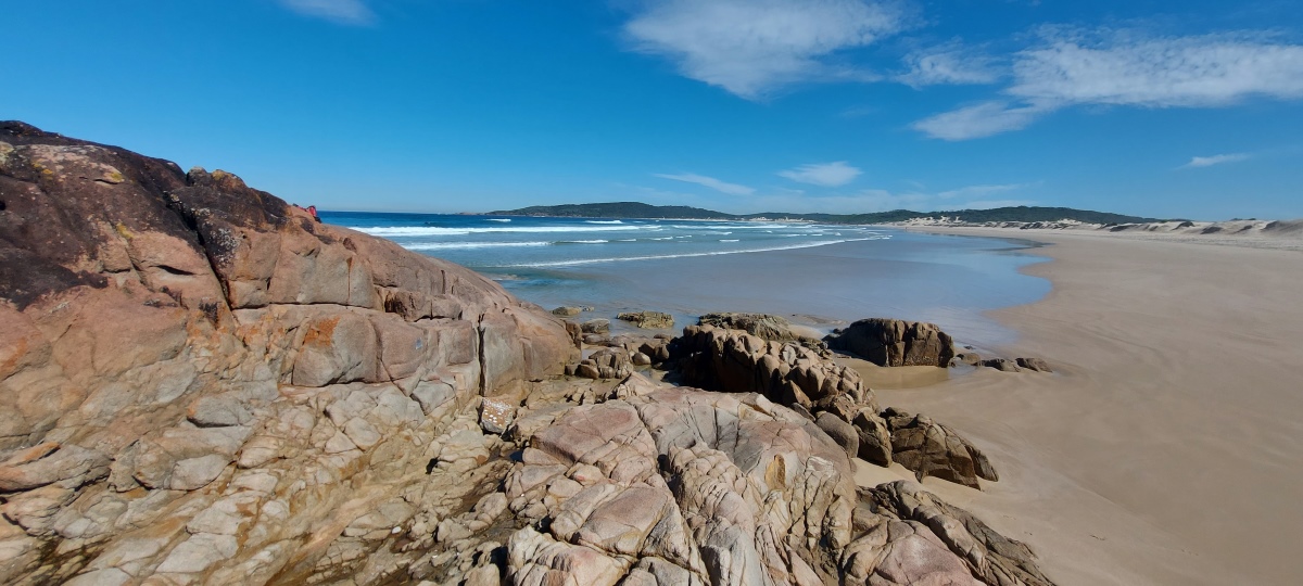
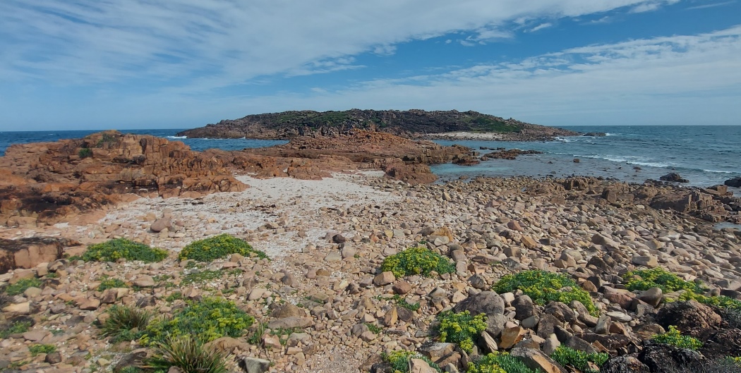
The most famous spot is Big Rocky, a small island just off the coast. This area looks best at low tide.
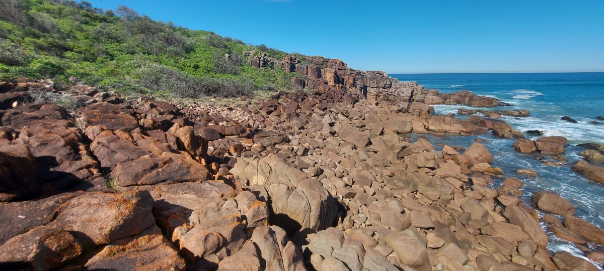
Rock hopping requires low tide too, otherwise some parts may be impassable.
① Boulder Bay Road in Fingal Bay. There is a sandy parking area with enough room for 4 or 5 cars. The track from here to Big Rocky is very well maintained, although for the first ten minutes the walk goes past a wastewater treatment plant which can smell a little sometimes. Apart from that it is a pleasant walk through beautiful bushland with a few hills.
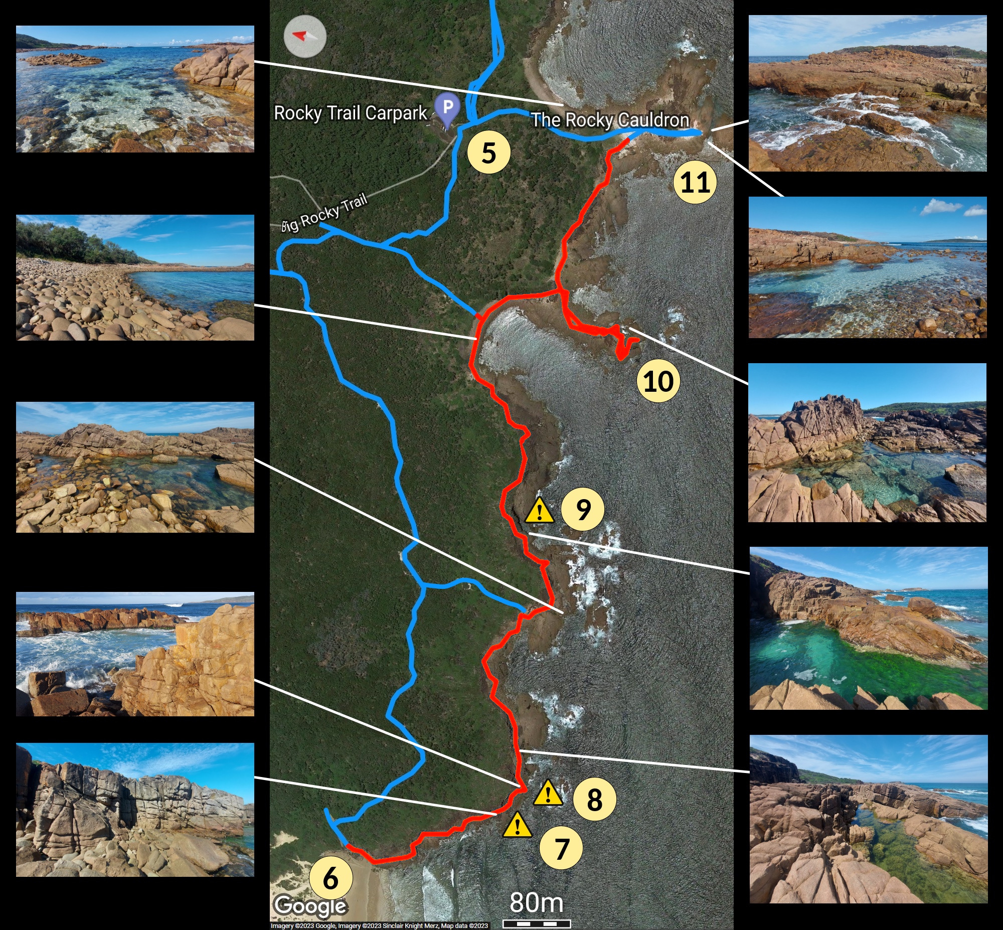
⑤ Big Rocky car park, which requires a four wheel drive. Enter from Gan Gan Road.
⑥ Samurai Beach by four wheel drive down an access trail near the koala hospital. It is possible to walk down the trail too, but beware of oncoming vehicles. Note that Samurai Beach is a clothing optional area.
⑤ to ⑥ — Big Rocky intersection to Samurai Beach: 20-25 minutes.
⑥ to ⑪ — rock hopping from Samurai Beach to Big Rocky: 1-2 hours.
I generally take 4-5 hours total, which includes plenty of time for photos and enjoying the surroundings.
Just walking from Boulder Bay Road to Big Rocky and back takes under 2 hours.

It is possible to go north from here back to the wastewater plant, but it isn’t especially interesting.
Going south is more challenging. Climb down through a boulder filled area and up the other side.

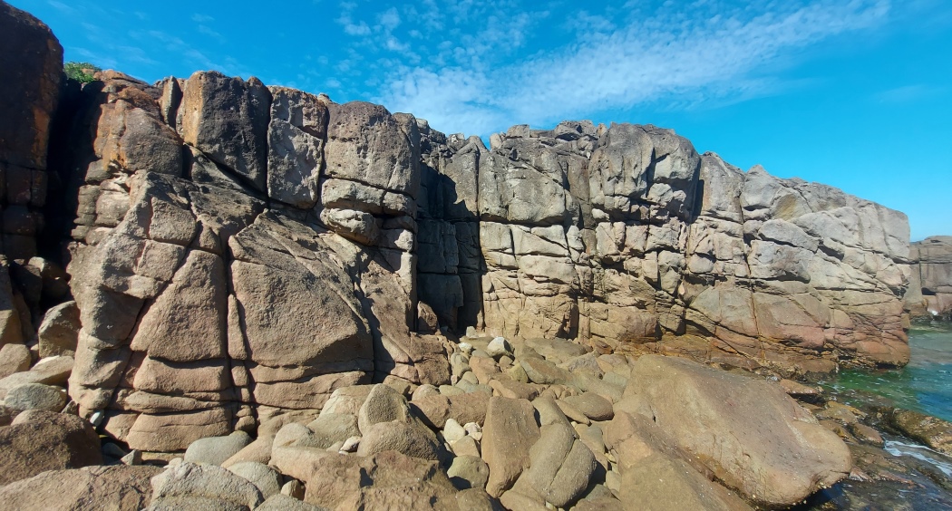
After crossing over some awkward rocks there is a section through thick low bushes with a semi-trail that can be difficult to follow (it is easier in the other direction). The “castle” at ③ is visible in the distance.
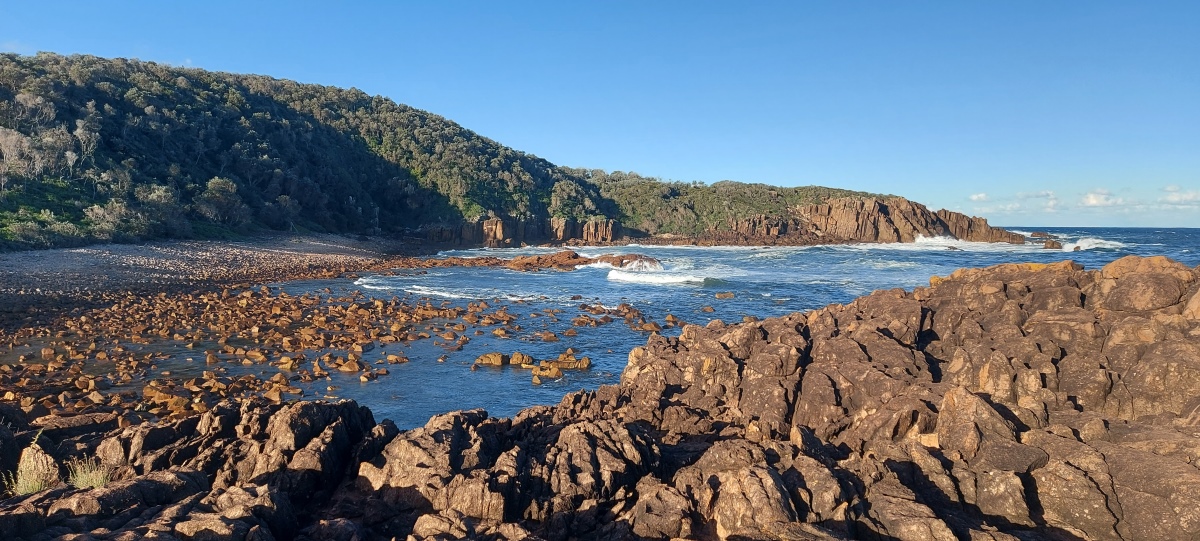
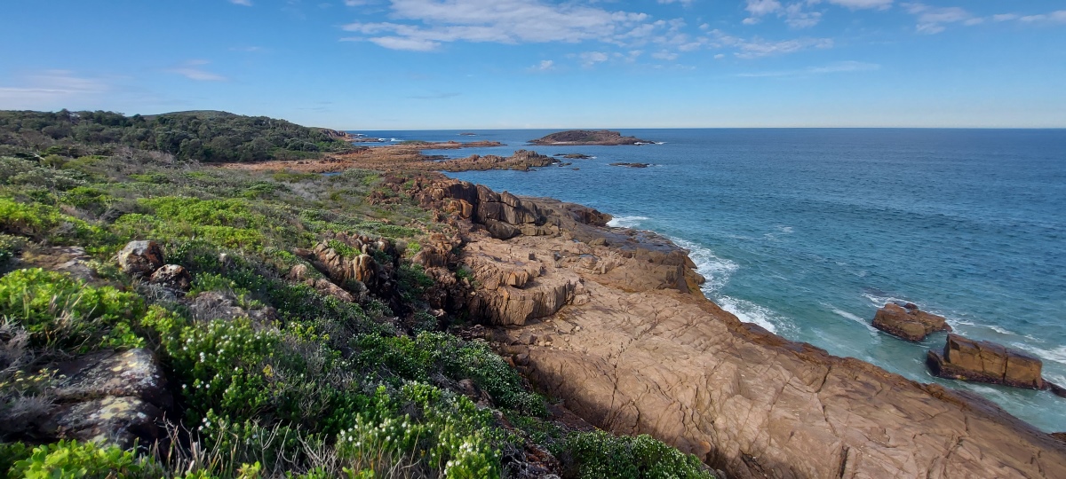
The bush section finishes near the end of a ravine. Continue along the coast to the ocean pool at ③.
Heading southeast (left) over some potentially slippery rocks leads to an ocean pool with a rock formation that reminds me of a castle.

Going southwest (right) from the side trail takes you to Snapper Point, which can have dramatic waves (video).
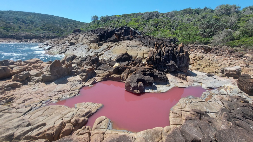
Beyond Snapper Point after some ups and downs there is an area with an intermittently pink pool. I have only seen it looking pink once, in early January 2024; two months later it was just an ordinary looking pool again.
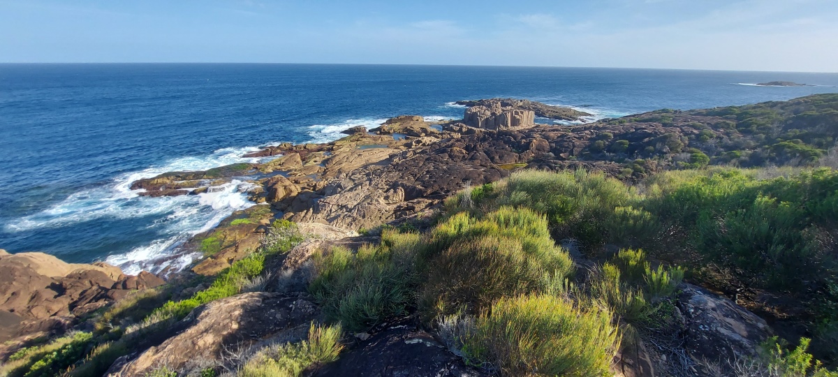
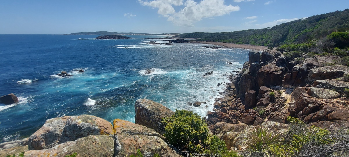
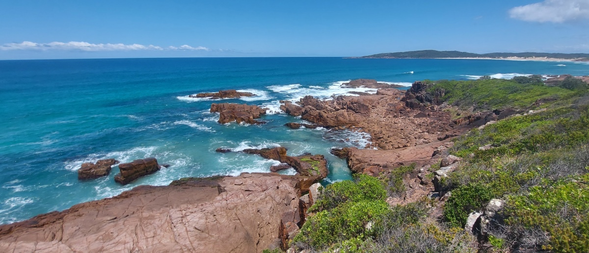
Continuing around the coast leads to a high cliff with a view of Little and Big Rocky.
Note: If the waves are too high, ⑦ and ⑧ can both be bypassed using a faint trail to the left over the top of the cliff.
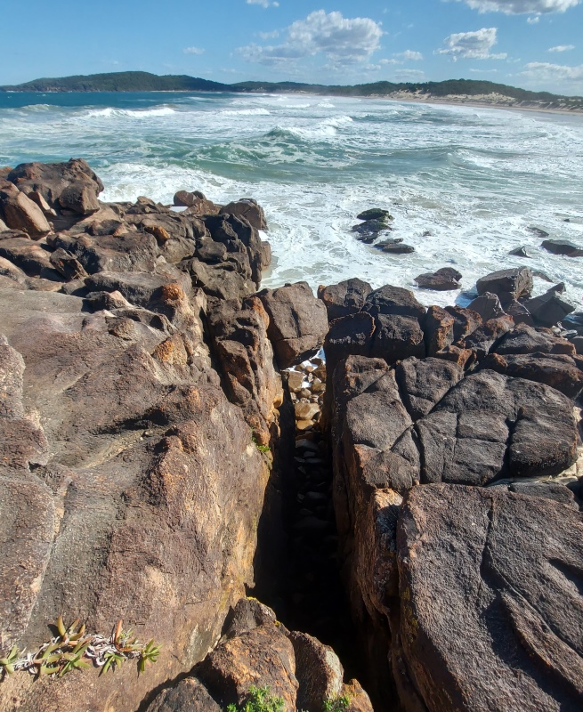
After a while you reach a cliff with a sloping section on the left. There are plenty of hand and foot holds so it is easier than it might look to climb up. Step over the gap once you reach the top.
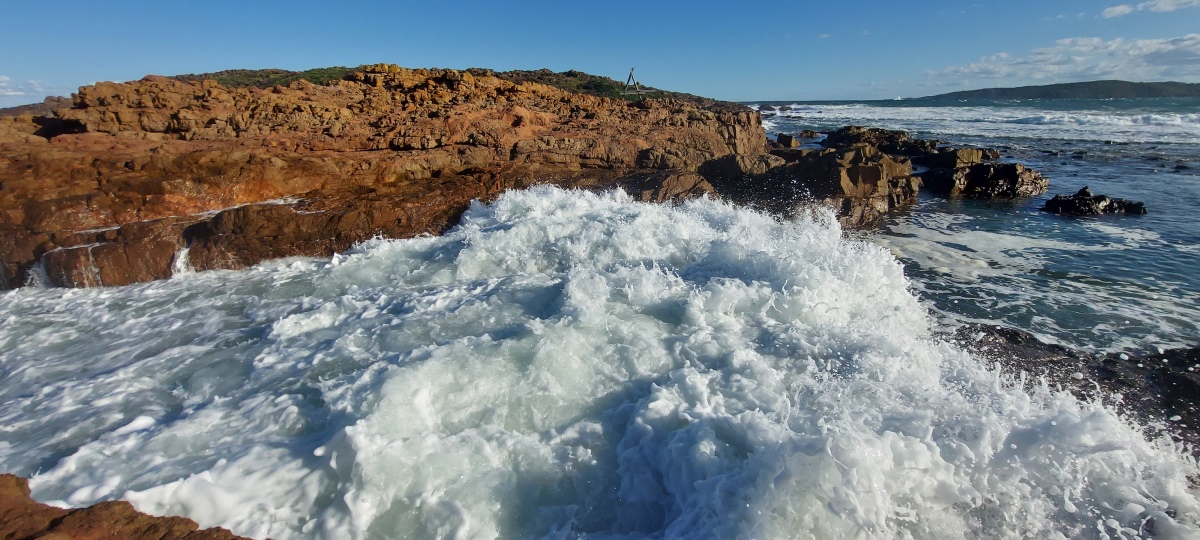
This section requires careful timing if there are large waves.
Climb up the low wall; you can use the adjacent rock to help. Be aware of waves coming up the channel. (At very low tide you can walk to the end of the channel and go around).

Getting down is slightly more difficult. Continue to the next edge and climb up a little to the left, then there are rocks jutting out on the other side that can be used as footholds to get down (it may be easier to climb down backwards). This photo is from the other side.
Step down onto the large rocks, being careful of approaching waves.
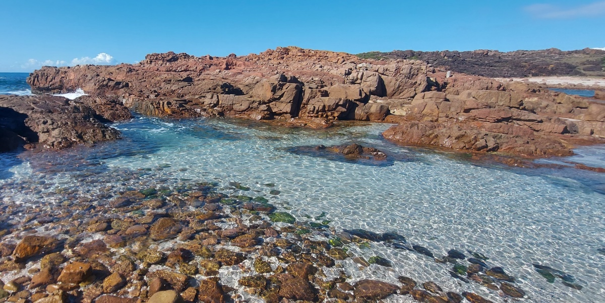
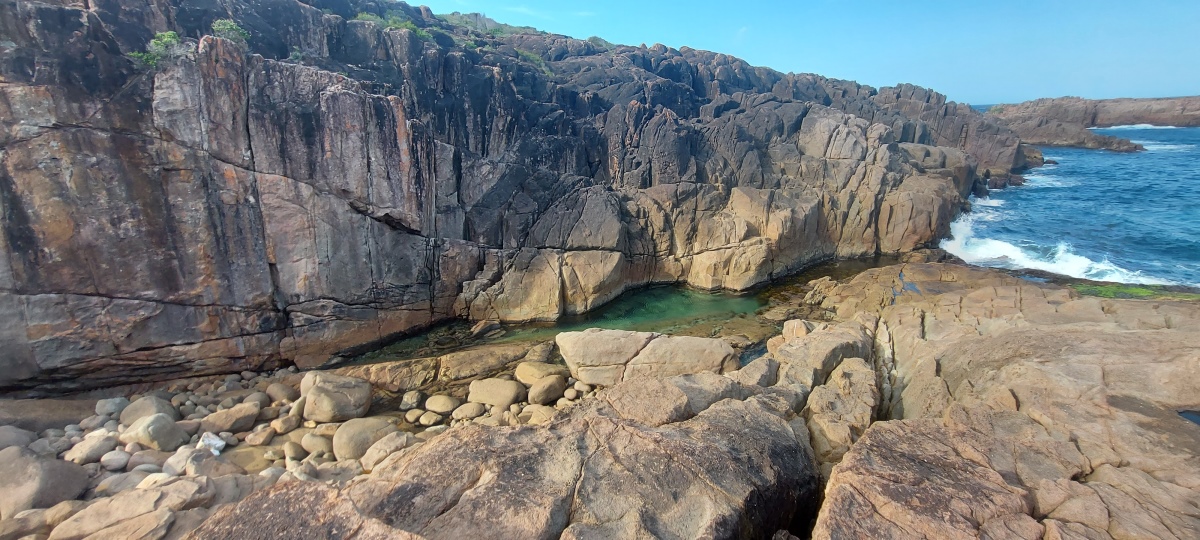
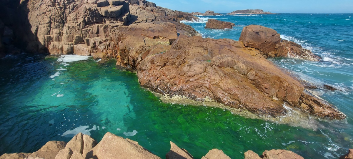
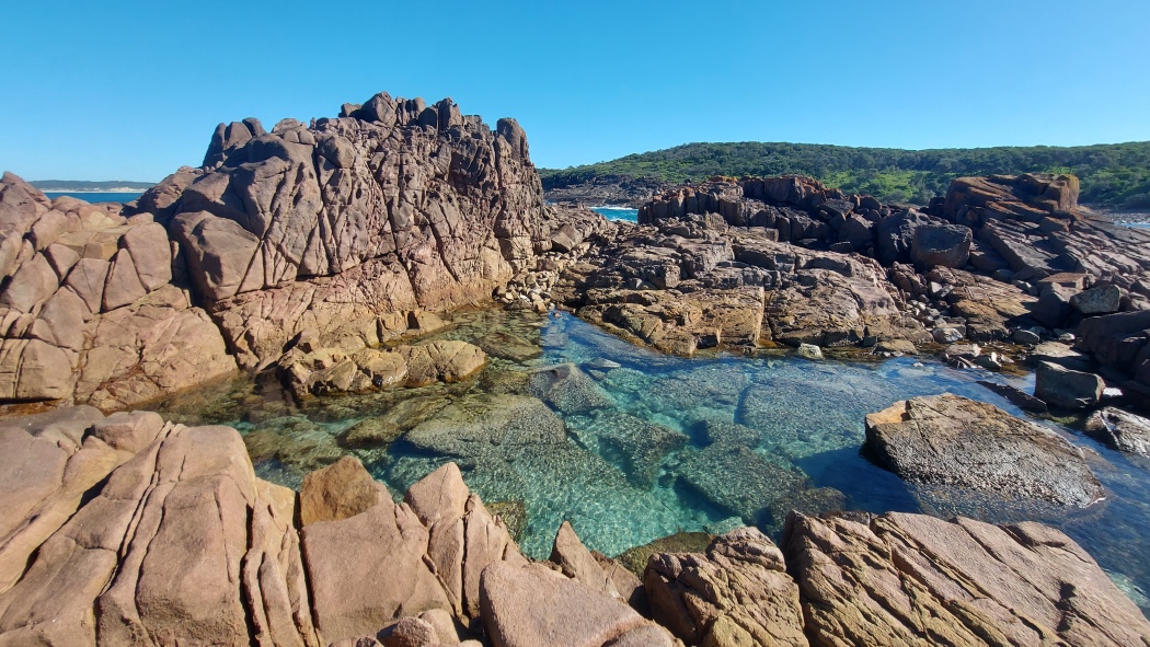
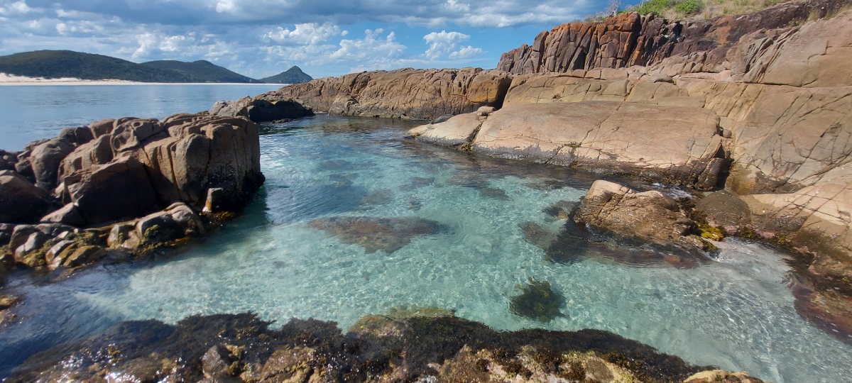
This is a very beautiful location when the water is clear. There can be strong waves over the rocks sometimes (video).
Climb up the rock slope to the top of the cliff (there are multiple ways up – left, right and middle), then find your way through the low bushes back down to the rocks on the other side. There is a faint path for some of the way.
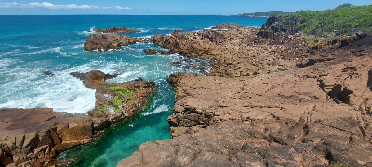
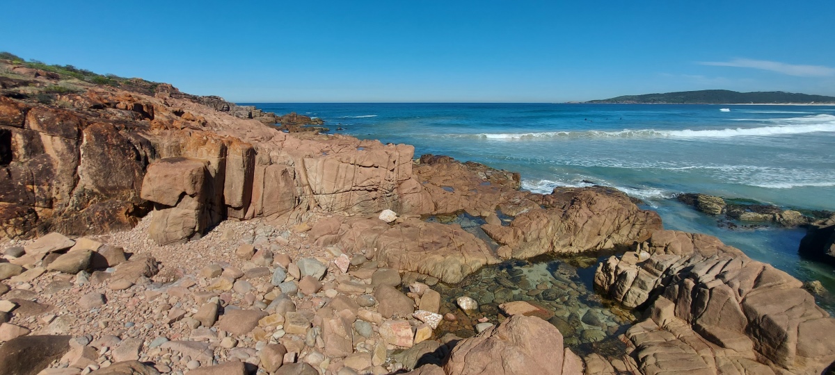
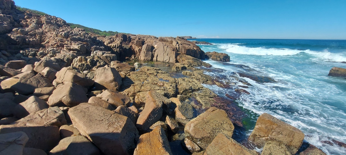
After descending again, continue around the rocks to the pebbly beach. The next section to Big Rocky is a little rough to walk over, which can be skipped if desired by taking the path up on the left.
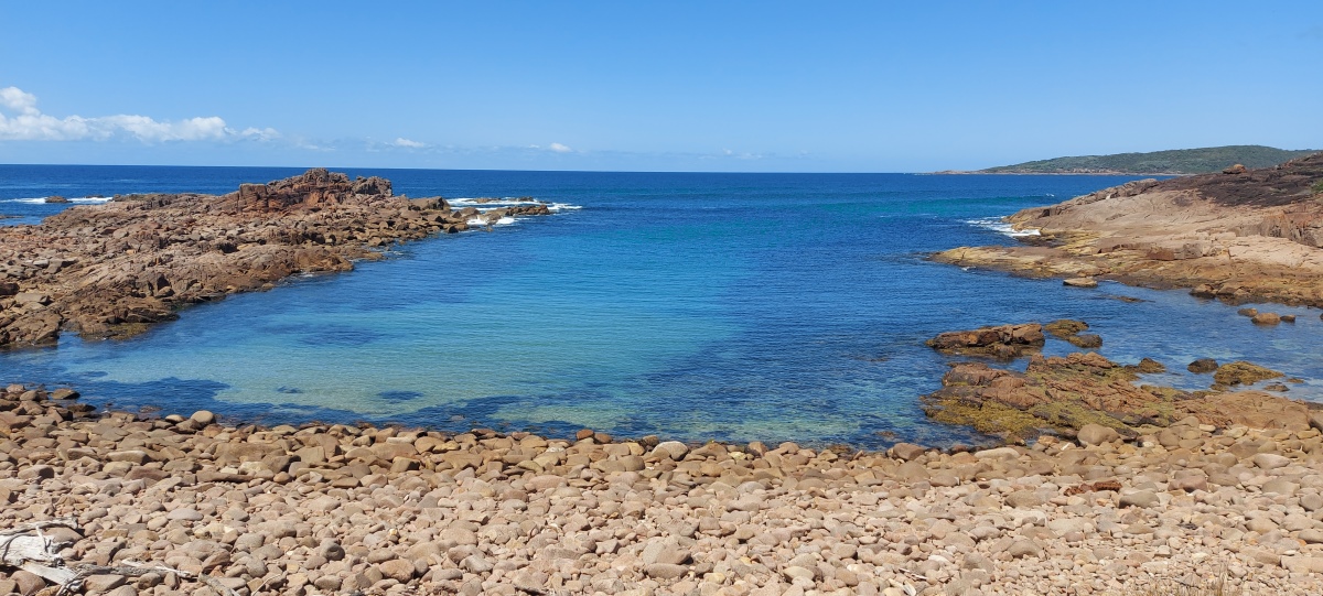
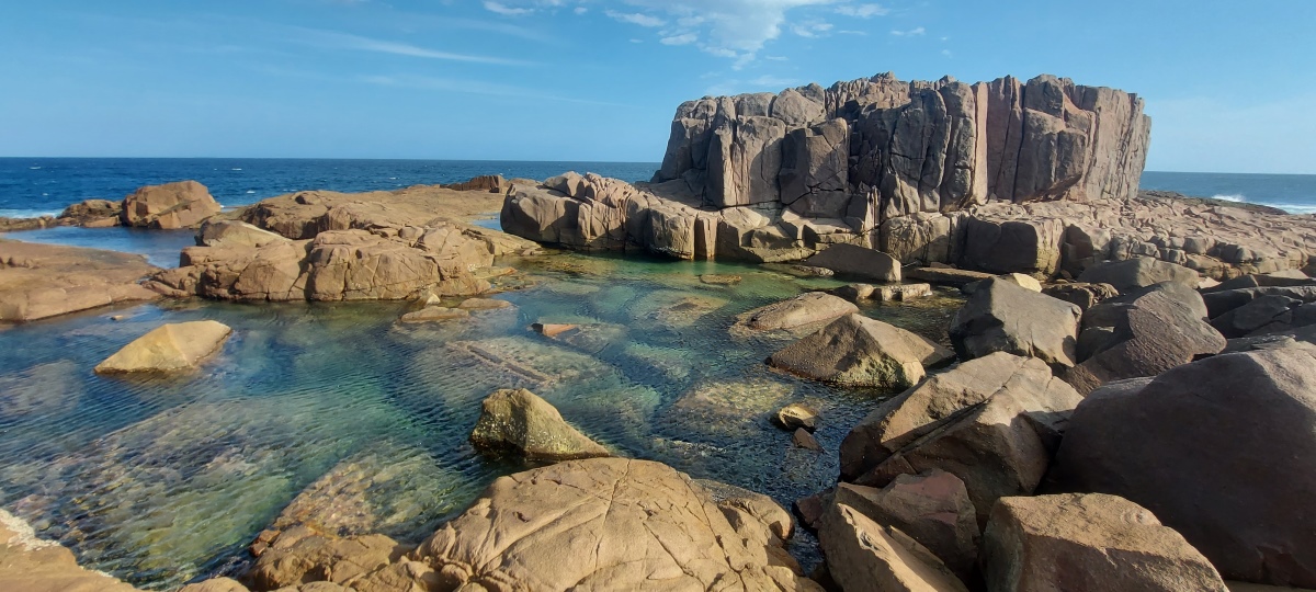
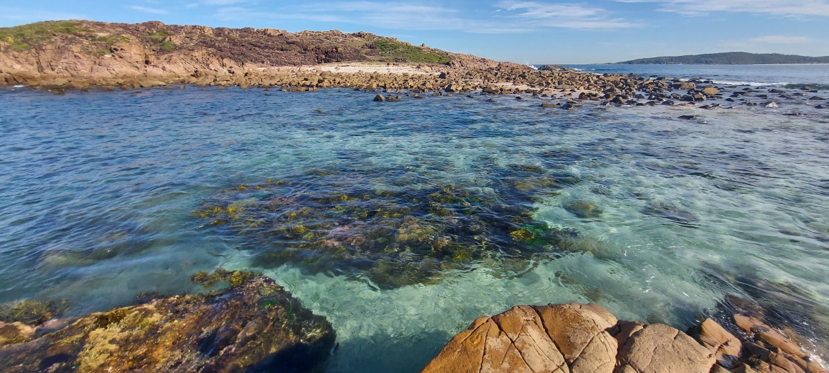
If you take a short side trip out along the rocks to the right before Big Rocky, you will find a secluded ocean pool (video). The rocks in this area can be a bit awkward to traverse.
It is possible to reach the far side of the pool by climbing around to the right then up over the top of the protruding rocks (or at low tide, you can take a more direct route across the rocks on the left side of the pool).
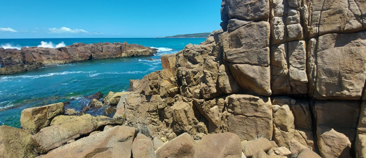
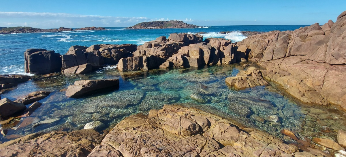
Towards the island there is a channel called The Rocky Cauldron, which is risky to cross any time other than low tide.
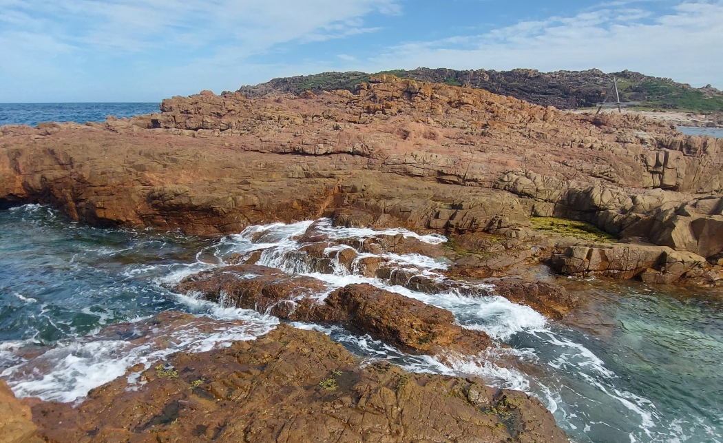
If the tide is fairly low, an alternate way across is via the stones to the right of the Cauldron. The tide can return quickly however, so keep an eye on it to avoid becoming stranded.

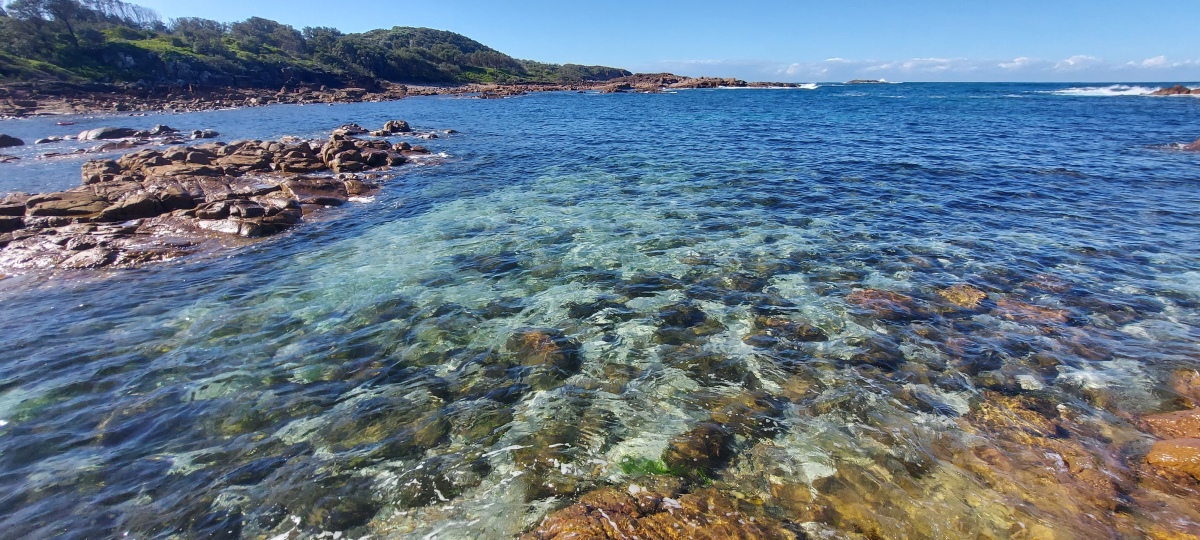
The area beyond the Cauldron has a beautiful view over the water (video).
Just north of the Big Rocky area is a shallow bay with nice water views too.
Here is a GPS track of the whole area with cliffs indicated by arrows. (The southmost cliff is close to Little Rocky; it is possible to climb, but this is not really recommended because many of the hand and footholds are just rocks embedded in dirt, and there is bush to get through at the top of the cliff).

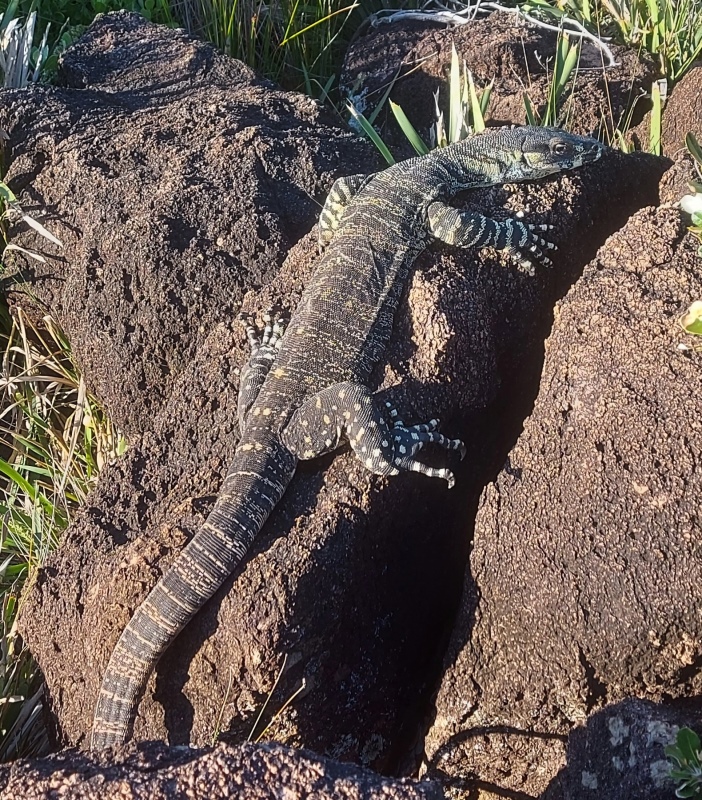
Lace monitor (video).
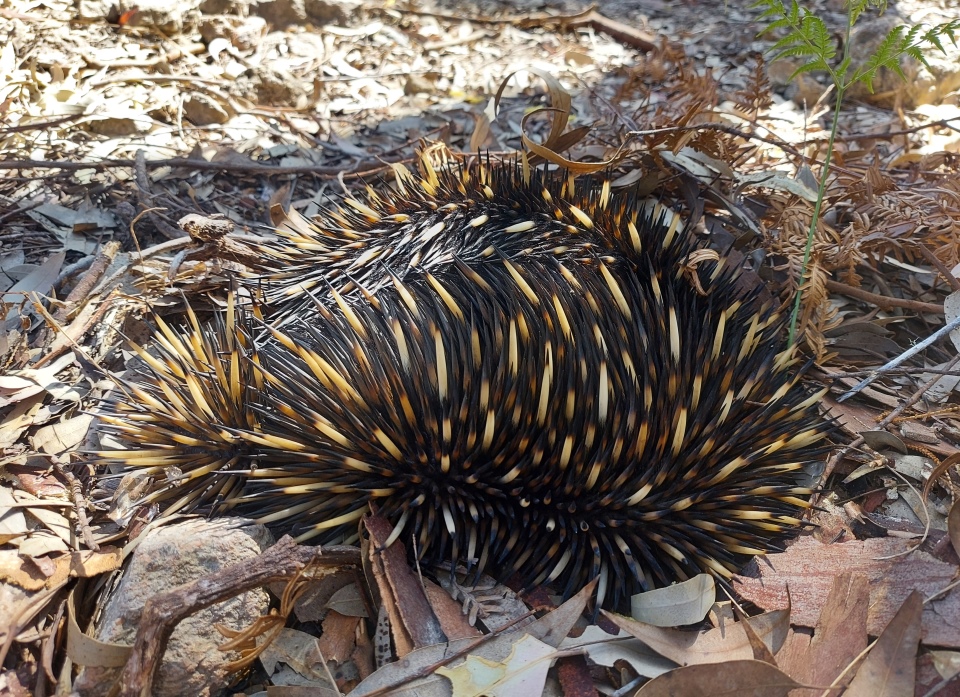
Echidna.
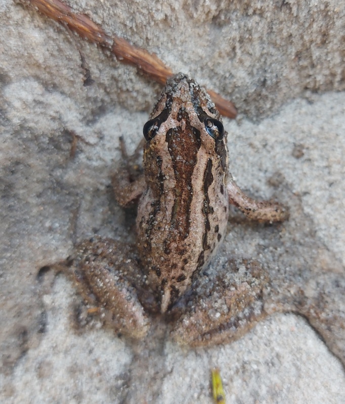
Frog.
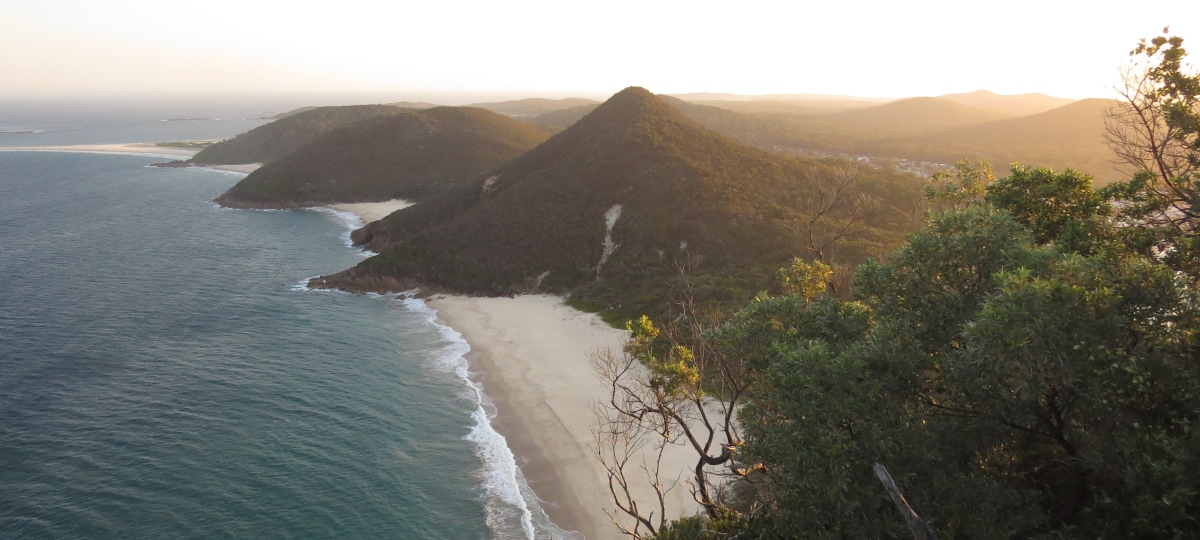
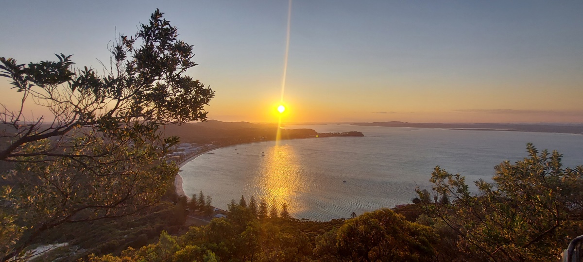
Nearby Tomaree Head has a steep but straightforward 1 km walk up to a lookout with some dramatic views.
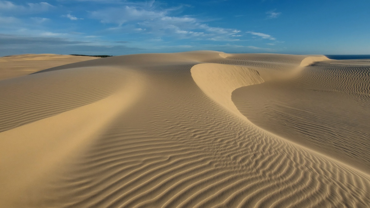
Another area to explore is Stockton Dunes at Anna Bay (which go for at least 30 km). There are various ways into the dunes, but the simplest is the Birubi 4WD access off Gan Gan Road.
Send questions or comments to:
[email protected]